
Today I was scared.
After spending an incredible weekend with 600 like-minded women at the inaugural Women Who Wander Outdoor Retreat, I can’t resist an overnight stay in Fredericksburg, Texas, on the way home to see the spectacular wildflower display. They say it’s the best in ten years. They’re not lying.
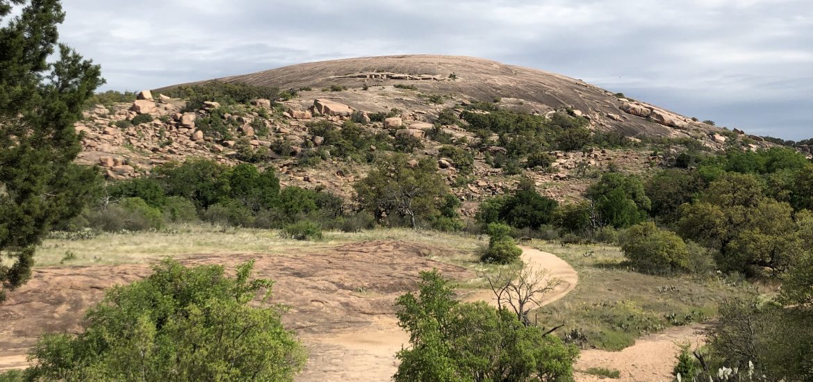
The Willow City Loop offers jaw-dropping displays of bluebonnets against gorgeous landscapes for thirteen breathtaking miles. As I exit the loop, I realize that I’m just minutes away from Enchanted Rock State Natural Area.
I’d been earlier this year, but fog and light rain kept the Summit Trail closed that day. Our group was relegated to the Loop Trail – one of the few remaining options in the small park – encircling the pinkish batholith’s base. I decide to return and tackle the summit solo.
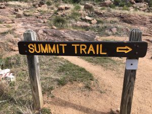
The Summit Trail at Enchanted Rock is short, weighing in at less than a mile.
Short but strenuous; after all, you will gain around 400 feet in that time, all while walking up the side of a rock.
I make my way to the pavilion, which indicates the start of the trail. Descending a small flight of stairs into a creek bed, I pick my way alongside boulders towards the base of the enormous granite dome.
In no time, the trail disappears into the side of Enchanted Rock. There are a few signs embedded in the granite, but they too soon disappear. I keep heading up with my head down.
Here’s the part where I begin to get nervous.
It’s steep, my breathing is getting heavier, butt and thighs are warming up, but nothing unmanageable. That’s not the problem. I’m worried about the trip back down.
Stopping several times, I look behind to survey the situation. What lies ahead is even steeper, and I consider turning back. I’ve always heard that you shouldn’t go up something you can’t get back down, solid advice, but I’m noticing that people are much older and much younger than me doing it with no trouble. At least that I can see. 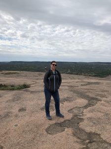
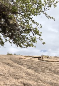
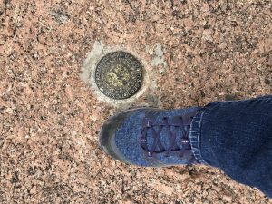
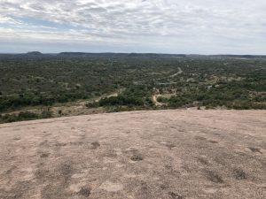
I continue, finally cresting the top where the trail flattens out considerably. Marveling at the power of nature, I enjoy all of the plants growing in pockets carved out of the stone. I look for vernal pools inhabited by tiny fairy shrimp, admire the stunning 360-degree views, and search out the USGS benchmark – proof that I made it to the summit.
Time to head back.
Down I go. I worry that I’ll slip, but my Keens feel sticky, and the rock doesn’t seem too slick. Easing down with baby steps, I recall a high school ski trip. To slow down, I zig-zagged my way through the snow while going down the mountain. I employ this tactic now – sans skis, and find it helpful and easier on the joints.
Arriving at a point that looks like I’m headed straight over a ledge, my concern grows. I know this can’t be right; I walked up – no hand over hand climbing. A small swell of panic rises in the back of my throat anyway.
Remembering a lesson I learned in previous adventures, I pick a point about 20 yards ahead of me and walk to it.
Then I choose another point and make my way there. I have found this technique helpful on the trail and in life. The sum of all parts can feel overwhelming, but by breaking a task down into pieces, small successes will build one on top of the other until the mission is complete.

Before I know it, I’m back down to the dirt trail. Within minutes I’m back to the car with another adventure under my belt.
If you liked this article, please share it. Be sure to join the conversation online. Follow on any of our social media platforms or join the 52 Weeks 52 Hikes Group on Facebook.
Starting your own hiking journey? Pick up a copy of the 52 Weeks 52 Hikes Journal now available. Track your treks, and relive your adventure.
Read how my journey got started by clicking here.
As always, thanks for reading!


